LION · Local Integrity Oversight Network

What the Public Record Shows: McKinney Site-Plan Case 25-0081SP

A primary-source brief on the McKinney Islamic Association site plan — what is documented, what the record answers, and the short list it does not.
Case 25-0081SP (SITE2025-0081) Body McKinney Planning & Zoning Site 5301/5311/5321 Virginia Pkwy (~5.57 ac) Compiled 2026-07-27
Read this first. This brief separates three very different things and labels every item accordingly: documented public-record facts, questions the record raises, and unverified claims now circulating that are not established. LION examines whether the City applied its own rules; it does not characterize any religious community, and nothing here is an accusation against the applicant. This is not legal advice. Items marked Unverified should not be repeated as fact. Every citation below links to its public source.
Two points the plan does not yet show it meets

These are the specific, code-cited questions a resident can raise so the Council approves only a compliant plan. A city must approve a plan that complies — and may reject one that does not. Click either to jump to the full detail and sources.

1 · The 15,000-sq-ft-per-building floor-area cap The PD limits any single building to 15,000 sq ft of floor area — a cap the height exception does not waive. The plan’s two-story buildings sit on 15,000- and 10,236-sq-ft footprints, so each appears to hold roughly double the cap, and the plan never states gross floor area to prove otherwise. Jump to the finding & sources → 2 · The 25-ft landscape buffer The height exception requires a 25-ft landscape buffer on every property line. The site plan labels both street frontages a 20-ft buffer — 5 ft short — while the landscape sheet says 25 ft. The two approved sheets cannot both be right. Jump to the finding & sources →
0
Public documents cited
0
Documented public facts
0
Questions raised for the City
0
Items needing a records request

Location & zoning

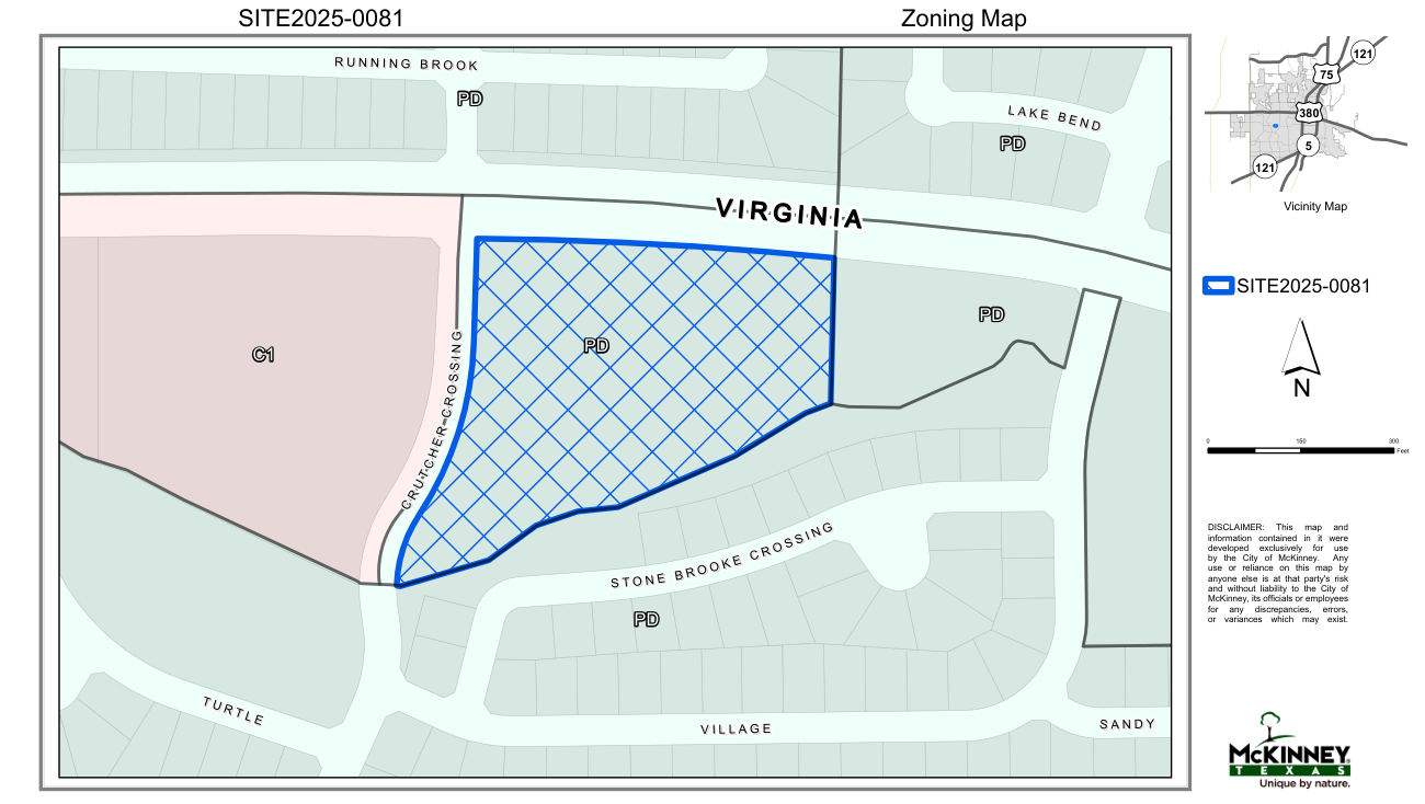
The tract at Virginia Parkway and Crutcher Crossing, and its zoning — from the City's own public "Project Maps" exhibit. Click either image to enlarge.
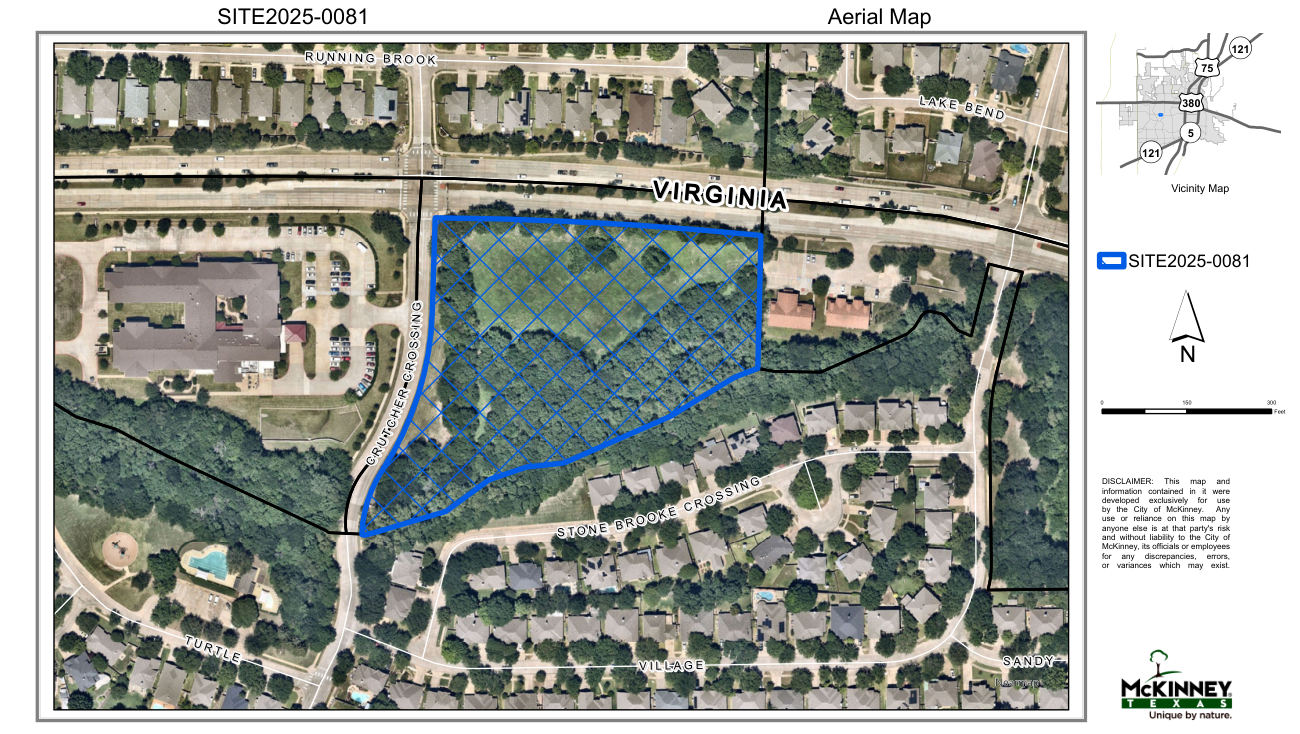
Aerial map of the site on Virginia Parkway
Aerial. The ~5.57-acre tract along Virginia Parkway. Source: City Project Maps exhibit.
Zoning map of the site
Zoning. The parcel under PD Ord. 97-05-34 (as amended 2017). Source: City Project Maps exhibit.

The case at a glance

Applicant / useIslamic Association of McKinney — religious assembly
ZoningPD-O (Office), Ord. 97-05-34 as amended 2017-04-041
Masjid~15,000 sf · 46 ft · 2 stories
Classroom bldg~10,000 sf · 38 ft · 2 stories
Gymnasium~7,000 sf · 35 ft · 1 story
Heard by P&Z2026-07-14 — on the consent agenda

How it got here

1997
Property placed in Planned Development Ord. 97-05-34, sub-district PD-O (Office). Base height limit: 35 feet.
2024
A rezoning request (case 24-0048Z / 24-0048Z2, PD → C1) draws 60+ speakers, is recommended for denial by P&Z, and is withdrawn.
2017 → 2026
PD amendment 2017-04-041 re-affirms the 1997 standards (adds a single-family option only). In 2026 the applicant returns with a site plan under the existing PD zoning — no rezoning — which is why it moves as a routine (ministerial) item.
2026-07-14
Site plan 25-0081SP heard by Planning & Zoning on the consent agenda (agenda posted 2026-07-08).
~2026-08-04
Unverified A City Council date is widely repeated but was not docketed as of this writing — which is normal (Texas requires only 72 hours' notice). Its absence today is not a finding.

The central question: does the height comply?

This is where most of the public conversation sits — and where the record is more nuanced than either "obvious violation" or "nothing to see."

The PD sets a 35-foot maximum building height; the plan labels the masjid at 46 ft and the classroom at 38 ft. But McKinney's base code (Chapter 146) supplies two documented ways a taller building can still comply, so "46 > 35 = violation" is incomplete:
§146-46(51)c — for pitched (hip/gable) roofs, height is measured to "the mean height level between eaves and ridge" (the midpoint, not the ridge), and expressly excludes "ornamental cupolas, domes and spires … penthouses … parapet walls not exceeding ten feet."
§146-129(1)c — in any district where churches are allowed, the primary church structure "may exceed the standard maximum height … 75 feet," conditioned on added setback (3 ft per 1 ft over), a minimum 50-ft setback, and a 25-ft landscape buffer on all lines.
So whether the 46-ft masjid complies turns on the eave/ridge measurement and on the exception's conditions — not on the ridge height alone. Both provisions: City of McKinney Code, Chapter 146 (PDF).

Findings — filter by status

Every item is tagged and every source links out. Click a status to filter.

The plans themselves

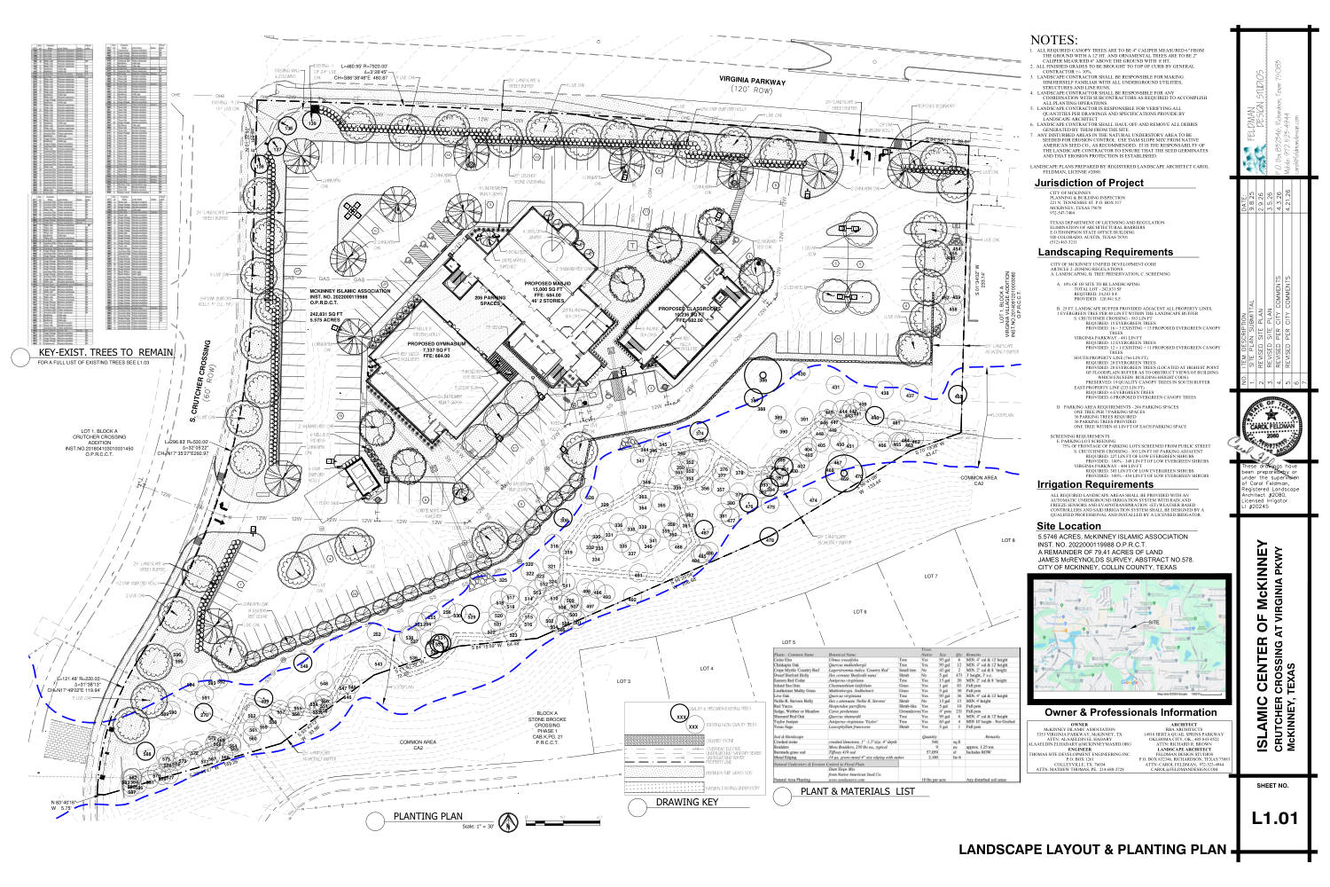
The two approved public sheets. The key finding above turns on what these two documents each say. Click to enlarge, or open the full PDF.
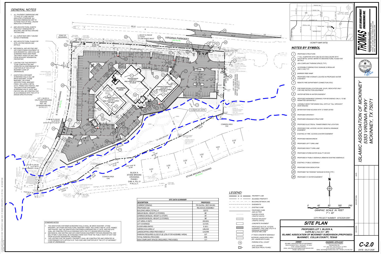
Proposed site plan sheet C-2.0
Site plan (C-2.0). Labels a "20′ STREET BUFFER" on the Virginia Parkway frontage. Full site plan PDF.
Proposed landscape plan sheet L1.01
Landscape plan (L1.01). States a "25 ft landscape buffer … all property lines" and notes evergreens set "to obstruct views of building which exceeds building-height code." Full landscape plan PDF.

Bottom line

The plan substantially complies — but on two points it does not, on its face, demonstrate compliance.

Most testable requirements are met: the religious-assembly use is permitted by right (no special permit needed), and parking, lot coverage, landscaping, buffer trees, screening, ADA, fire lanes, and sidewalks all meet the code as shown. No clean, standalone violation is certain. But on two points the plan does not demonstrate compliance, and under the law the burden is the applicant’s: (1) the 25-ft landscape buffer the height exception requires — the controlling site plan shows 20 ft on both street frontages while the landscape sheet shows 25 ft, so the set is internally inconsistent; and (2) the PD’s 15,000-sq-ft-per-building floor-area cap, which the plan’s own two-story footprints appear to exceed and which its stated figures do not resolve. A city council must approve a plan that complies and may reject one that does not — so the Council would have a lawful, code-anchored basis to require both reconciled (a consistent 25-ft buffer on every line, and floor plans proving no single building exceeds 15,000 sf) before the plan can be found compliant. The architectural floor plans and elevations are the records that would settle it.

What would require a records request (PIA)

Almost everything above is public. Only these internal documents would need a Texas Public Information Act request.

Documents cited

Every source is a public record, linked directly. Nothing in this brief required a records request.